About Peru
 Peru ► Peru’s Geography ► Lima ► Cuzco ► Arequipa ► Puno ► Nazca ► Pisco ►
Holidays in Peru ►
Treks in Peru ►
Tours in Peru ►
|
|
|
|
|
Due to factors such as Peru’s location just south of the equatorial line, the Andean mountains distribution and the cold marine current along its coastline, Peru has one of the most varied weathers and landscapes in the worl.
Peru is normally divided into three large geografical regions :
the COSTA (Coast) is the desert, flat or undalating territory adjacent to the ocean, The Peruvian coast is a microclimatic region. The region is affected by the cold Humboldt Current, the El Niño Southern Oscillation, tropical latitude, and the Andes mountain range.
The central and southern coast consists mainly of a subtropical desert climate composed of sandy or rocky shores and inland cutting valleys. Days alternate between overcast skies with occasional fog in the winter and sunny skies with occasional haze in the summer, with the only precipitation being an occasional light-to-moderate drizzle that is known locally as garúa. These regions are usually characterized by having mildy cold lows (14 C°) and also mild highs (30 C°). Temperatures rarely fall below 14 C° and do not go over 30 C°. An exception is the southern coast, where it does get a bit warmer and drier for most of the year during daytime, and where it can also get much colder during winter nights (8 to 9C°). The occasional drizzle or fog of the central and southern coast is common during winter months, but even during summer days there are some foggy days. One must not forget that although it may not be as warm as typical tropical latitudes, the sun will hit and strike as if you were in any other tropical place.
The northern coast, on the contrary, has a curious tropical-dry climate, generally referred to as tropical savanna. This region is a lot warmer and can be unbearable during summer months, where rainfall is also present. The region differs from the southern coast by the presence of shrubs, equotorial dry forests , mangrove forests, tropical valleys near rivers such as the Chira and the Tumbes, and is blessed with clear, sunny skies for most of the year. The average temperature is 25 C°.
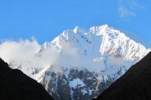
The SIERRA (Andean Mountain Ranges) is the mountain territory corresponding to the Andean range. The Andes shelter the largest variety of climates in the country. The climate is semi-arid in the valleys and moist in higher elevations and towards the eastern flanks. Rainfall varies from 200 to 1500 mm per year. The rainy season starts in October and ends in April. The rainiest months are January through March where travel can be sometimes affected.
The western slopes are arid to semi-arid and receive rainfall only between January and March. Below the 2500 m mark, the temperatures vary between 5 and 15 °C in the night versus 18 to 25 °C in the day.
Between 2500 and 3500 meters the temperatures vary from 0 to 12 °C in the night and from 15 to 25 °C during the day. At higher elevations from 3500 to 4500 meters, the Puna ecoregion, the temperature varies from −10 to 8 °C during the night versus 15 °C during the day.
The northernmost regions of the Andes around Cajamarca and Piura regions have Paramo climates.
The SELVA (jungle) The eastern portions of Peru includes the Amazon Basin or selva baja, a region that is larger in the north than in the south. Representing roughly 60% of Peru's national territory, this area includes the Amazon, Marañón, Huallaga and Ucayali Rivers. It is a vast tropical forest with countless rivers and streams. Rainfall varies from 2000 to 4000 mm per year.
|
|